For generations, the people of Boralani have understood a simple truth: we are an island nation because of the sea, not merely beside it.
The ocean feeds us, connects us, protects us, and at times humbles us. It is our highway, our pantry, our weather-maker, and our history book. Long before satellite navigation or hydrographic surveys, Boralani navigators crossed these waters by reading stars, currents, winds, and seabirds with a skill that still commands respect across the Pacific.
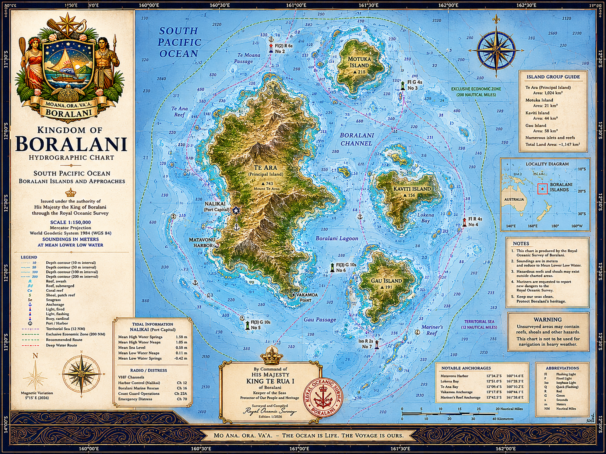
Today, we are pleased to unveil a new official-style Hydrographic Chart of the Kingdom of Boralani and its surrounding waters.
While created as a commemorative and educational work rather than a true navigational document, the chart reflects the maritime character of our islands and the enduring importance of seamanship within Boralani society. From reef passages and lagoons to anchorages and protected marine areas, the chart attempts to capture the feeling of a Pacific kingdom whose destiny has always been tied to the horizon.
Particular care was taken to incorporate symbols of the Crown, traditional voyaging culture, and the nautical heritage that continues to shape life here in Boralani. The Royal Seal, island place names, maritime legends, and ceremonial styling all reflect the blend of old Pacific traditions and modern statehood that defines the kingdom today.
In many countries, maps are simply technical objects.
In island nations, they are stories.
They remind us where our fishermen travel before dawn, where storms gather during cyclone season, where ancestors once voyaged by canoe, and where the boundaries of our stewardship begin. A chart is not merely a drawing of land and water. It is a portrait of responsibility.
We hope readers enjoy this small addition to the growing visual world of Boralani.
As always, may the seas remain calm, the reefs visible, and the trade winds favorable.
The chart and other reference documents can be found here.